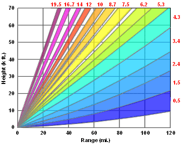
| Doppler Radar Precipitation Volumn Coverage Pattern (Quickest operational mode) |
Values in red represent the different elevation angles in this VCP. This table shows the approximate height and width of the radar beam with distance from the radar site. The radar will complete one volume scan (14 elevation scans) every five minutes.
 |